
Gahanna ZIP Code Coverage
The documented postal focal point for Gahanna is 43230. It appears on current City public-records and Planning contacts, and the official USPS listing identifies both a Gahanna Post Office and Gahanna station using that postal geography. That makes 43230 the supported starting point for a Gahanna ZIP code directory search. It does not establish that every address carrying 43230 sits within city limits, or that every municipal address has been proved to use that one code.
| ZIP or facility code | Documented Gahanna relationship | Postal location | Research note |
|---|---|---|---|
| 43230 | City contact addresses and the primary documented Gahanna residential/postal geography | Gahanna Post Office and Gahanna station | Use USPS for an exact delivery address. |
| 43218-9996 / 43218-9998 | Gahanna Annex and CityGate retail facilities in the USPS listing | USPS facility addresses | These facility codes are not proven residential delivery ZIPs. |
| Other ZIPs | No definitive source captured for every current municipal address | Verify address by address | Do not list a nearby code based on assumption alone. |
Gahanna's government and postal systems use different boundaries for different work. The coverage table is deliberately narrow because the research did not identify an authoritative master list for every ZIP serving every present municipal address. Exact delivery validation is the safer route.
Note: A ZIP result identifies postal delivery geography, not city jurisdiction, a school district, a tax district, or a voting precinct.
Gahanna 43230 Postal Center
The USPS Gahanna Post Office listing is at 246 Lincoln Circle, Columbus, OH 43230-9997, with telephone 614-471-9174. USPS also lists a Gahanna station at 106 Mill Street, Columbus, OH 43230-9913. The Columbus postal-city wording in those listings is a reminder that a postal label and a municipal boundary are separate systems. Use the address-specific result, not the city name in a county field, when delivery information is the question.
The separate 43218 facility codes belong to USPS-listed Gahanna Annex and CityGate retail facilities. They should not be presented as general residential ZIPs. Nothing in the research established a residential service area for 43218, so a responsible Gahanna ZIP code directory keeps that distinction visible.
The Gahanna GIS Maps page provides the local map entry point for municipal geographic review.
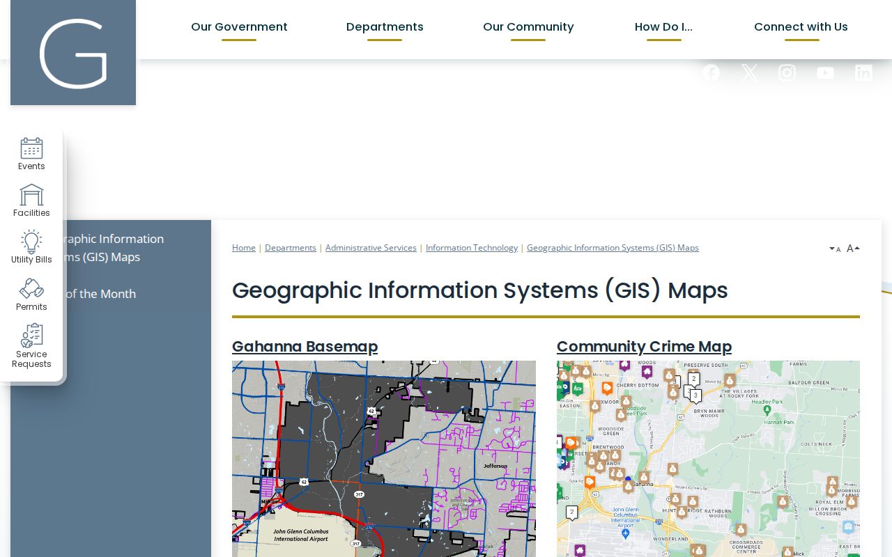
City map layers help test municipal geography after USPS confirms delivery. They do not replace the USPS result for the ZIP assigned to a specific mailing address.
Gahanna ZIP Code Validation
The official USPS ZIP Code Lookup is the first check for a precise Gahanna address. A parcel system may show a postal city or a tax mailing address that differs from the address supplied to USPS. That is not a defect that a searcher should resolve by inference. Preserve the USPS result as delivery information, then use city and county tools for the separate jurisdiction and property questions.
- Enter the full physical address in the USPS ZIP Code Lookup and save the returned city and ZIP as mailing information.
- Enter the number and street in Gahanna Connect or the county property search to confirm the parcel and municipal map layer.
- Keep the parcel ID and legal description with the address result if a tax, deed, permit, or plat record is needed.
- Use the city address-grid, final-plat, as-built, or annexation route if an older address does not match a current result.
- Move to the Gahanna street directory only after the ZIP question has narrowed to a particular street or parcel.
This sequence avoids a common local error: treating the postal city shown on one record as proof of municipal status. It also avoids turning a property owner or tax-mailing field into a list of people who live at an address.
Gahanna ZIP Code Portal Limits
Gahanna's local portals do not offer one universal ZIP search. Gahanna Connect has a ZIP result field and an address, parcel, and owner workflow, but the released configuration does not document a dedicated ZIP-input filter. The Franklin County Auditor exposes address, owner, parcel, subdivision, map, and intersection paths, not a documented ZIP filter. The Treasurer accepts name, street address, parcel ID, and a search term. Each route is useful after an address is known, but none should be advertised as a complete ZIP-wide resident search.
| Gahanna portal field | Type | Documented use | ZIP limit |
|---|---|---|---|
| Site Address contains | Text | Gahanna Connect parcel search | Result can show Zipcode; no dedicated ZIP input documented. |
| Parcel ID exact match | Text | Gahanna Connect tax-parcel search | Identifies one parcel, not a ZIP list. |
| Owner Name contains | Text | Gahanna Connect tax-parcel search | Owner data is not a ZIP filter or a residence finding. |
| Address / Owner / Parcel | Search modes | Franklin County Auditor Property Search | No documented ZIP filter in the inspected interface. |
| Name / Street / Parcel | Text fields | Franklin County Treasurer search | No ZIP field documented. |
ODRC does have a ZIP field, but the research limits it to people in APA supervision or violators at large. It is not a ZIP directory. Ohio's voter form is name-and-county based, while the SOS voter-data page provides a County List rather than a published ZIP selector. County GIS or data fields may help only when a live tool actually exposes a ZIP column or filter, and every result still needs individual verification.
Gahanna City Map Geography
Gahanna Connect is the city map layer for a municipal question. Its site-address records keep Municipality, USPS Municipality, and Zipcode as distinct fields. Its tax-parcel result can show a parcel ID, tax or school district, property class, site address and ZIP, legal description, subdivision or condominium information, owner names, owner mailing, tax-mailing fields, and a link to the Auditor. The map can also select graphically by point, line, polyline, extent, circle, or polygon and uses a 500-foot default buffer.
The city GIS adds Municipal Boundary, address grid, centerlines, parcels, subdivisions, original lot lines, zoning, flood, and planning layers. Those layers can answer which municipal system applies to a location. They cannot validate postal delivery by themselves. The Auditor and Treasurer may display a Gahanna site or legal description while a mailing or postal-city field says Columbus, so each field needs its own label in notes.
Note: ZIP, Municipality, and USPS Municipality appear separately in Gahanna Connect because they answer different geographic questions.
Gahanna Address Labels
A Gahanna ZIP code directory becomes more accurate when it preserves each address label rather than merging them. USPS is the delivery authority for the mailing ZIP. The Auditor links the site address to the parcel. The Recorder works with the parcel identifier and legal description for recorded property research. A mailing or tax address identifies where correspondence is sent, which can differ from the location of the property. The difference can reflect an estate, trustee, organization, or another correspondence arrangement.
- ZIP Code
- A USPS postal-delivery code used to route mail for a particular address.
- ZIP+4
- An added four-digit delivery detail used with a ZIP Code for a narrower postal destination.
- Facility code
- A code associated with a USPS location, not proof of a general residential delivery area.
- Carrier route
- A USPS delivery grouping; it is not the same as a city boundary or a property parcel.
- Legal description
- A recorded description of land, such as a lot or subdivision reference, used to identify the property in documents.
Keeping the labels separate allows a researcher to compare a current delivery result with a deed, tax record, permit, or older directory without inventing a connection that the record does not make.
Gahanna Address Grid Fallback
When an older listing conflicts with a current Gahanna address, the permanent city address records are the fallback. ENG-206 Certified Addresses includes formal requests, address assignments, an address plat book, and an address grid. The city's retention schedule also keeps final plats, as-builts, and annexation files permanently. A request for a particular record can help explain how a parcel acquired a site address or why an older document uses a different description.
Use the City public-records route when the needed material is not searchable online. Name the address, parcel or subdivision, expected record series, and approximate date. Gahanna accepts NextRequest submissions, but a request does not have to use a form or give an identity or reason. The Ohio Public Records Act, commonly the Sunshine Law, ORC 149.43, applies to existing nonexempt public records; it does not require the City to create a new ZIP-based compilation.
Note: No official source located a complete citywide renumbering schedule, so the address-grid and plat record should decide a specific conflict.
Gahanna Postal Research Paths
The practical order is USPS for delivery, Gahanna Connect for city geography, the Franklin County Auditor for the parcel, and Franklin County Recorder Cloud Search for a recorded document. The Franklin County Treasurer offers a separate tax-account route by name, street address, or parcel ID. Use the portal that holds the relevant record rather than making a postal field carry every question. A permit, zoning file, or city plat belongs with Gahanna Planning or the Records Coordinator; a deed belongs with the Recorder; a current property field belongs with the Auditor.
For an official map or boundary question, begin with Gahanna GIS and then verify the municipal boundary or address-grid layer. For a federal delivery question, return to USPS. For a voter question, use Ohio SOS My Voter Information for the individual name-and-county verification route, or contact the Franklin County Board of Elections about a defined public record. Protected voter data is not part of ordinary public display.
Gahanna ZIP Code Boundaries
A ZIP Code is a postal-delivery geography, while Gahanna city limits are a municipal-boundary question. An address can have a Gahanna site or legal description and a Columbus mailing or postal-city field. It can also fall near a ward, precinct, school, or tax boundary that does not match the delivery pattern. The city map and the county parcel record should be checked live for the specific question instead of guessed from the ZIP alone.
A ZIP code directory cannot provide a complete person-by-person list for an area. Available records support address, parcel, delivery, and government-geography research. They do not make protected voter addresses, utility customers, motor-vehicle information, or confidential files available. Ohio Safe at Home participants can use a substitute address, and a missing result can reflect lawful confidentiality rather than an error.
Boundary check. Validate postal delivery with USPS, municipal status with Gahanna GIS, and parcel facts with the Franklin County Auditor before relying on an address field.